Mount Baldo in Vittorio Veneto
- Medium - Low difficulty
- Not for young children
- 3 h
- Distance: km 9,5
- Elevation gain: m 460
Mount Baldo in Vittorio Veneto
Table of Contents
ToggleMonte Baldo Vittorio Veneto, the summit of the valley
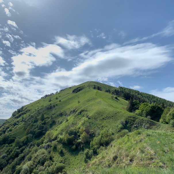
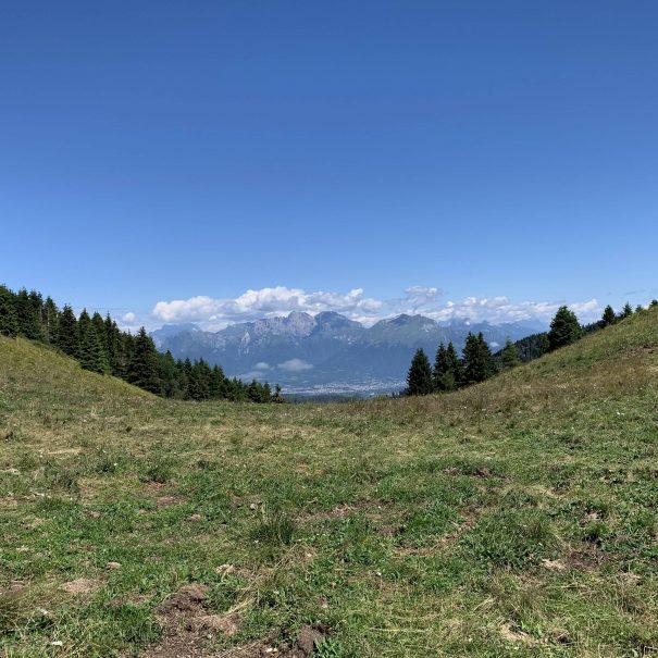
In this simple excursion, we will take you to discover the summit of Monte Baldo, only 597m high but guaranteeing a magnificent view of the valley, with the town of Revine Lago surmounted by Monte Frascon, Monte PIzzoc and, on the opposite side, the Victorian hills. The beauty of this itinerary, with a modest difference in altitude that lends itself to all types of legs, lies in the route, which runs along the ridge line of what is the highest of the peaks that encircle the Vallata in the western area.


Photographic scenarios
You will not be disappointed, our trails deserve many photos that you can share with all your friends
Suggested period
This route is recommended in every season of the year
Professional hiking guide
This excursion includes the possibility of booking a guide who will accompany you throughout the day, letting discover you the anecdotes and curiosities of these places
Free park
This itineraries include free parking where you can leave your vehicle
Book your guided excursion today
Do you have any questions?
Feel free to contact us and we will be happy to answer all your questions
The itinerary: Mount Baldo in Vittorio Veneto
You can park your car in Serravalle di Vittorio Veneto, in the pay car parks in Via Casoni or in the tree-lined avenue of Via Cavour. From here, once you have reached the picturesque village of Serravalle, take Via Roma, at the historic pizzeria ‘Al 128’, continuing until you come to the Castrum di Serravalle and turn into Via Caprera.
Go straight ahead as far as the tavern ‘La Vecchia Serravalle’, then turn left towards the locality ‘Con Bassi’ where, after passing through an archway and through the village, you will find a path that climbs into the woods. From here you will come to a clearing with vineyards, from which the path continues upwards and then to the left, in the direction of the locality of “Con Alti” where you will come to an asphalt road that passes under a porch and then through the houses.
At the end of the road, at the fork, we will turn left and the road will turn into a mule track: these are the Vie dell’Acqua (Water Paths), which will take us to the village of Nogarolo, passing through the locality of “Prese” (which owes its name to the water intakes that once ran through it) and “delle Selve”, with their splendid centuries-old chestnut trees that provide shade and coolness in summer.
When we reach Nogarolo, after filling up with water at the fountain located below the church and having refreshments at the Codirosso inn, we are ready to set off again towards Monte Baldo, the true stage of our excursion: we continue towards the end of the village, along Via dei Montagnai, until we take path 1051, which bears the signs for Serravalle and enters the woods along a historic mule track. On reaching the ruins of Case Checuz, the path changes to path 1043 and, after a short stretch, reaches the meadowy area of Pian de Sitada, then turns left and climbs up to the Valèta dei Piai pass. Continuing along the edge of the mountain ridge, from here we immediately reach the summit of Monte Baldo (550 m), with its large wooden cross and its view of Revine, the Vallata and the Belluno area to the north and the Victorian hills to the south.
From here we begin the descent that will take us back to our starting point: we continue on to Borgo Vignola, intercepting the ruins of the Castel di Montesel and, a little further on, the panoramic terrace on Monte Cucco, above the secret gardens, with the remains of the small Church of Sant’Antonio Abate. From here we continue along Via Piai, until we return to our starting point, passing under an arcade and coming out at the price of the pizzeria ‘Al 128’ from which we had departed
Similar itineraries
If this excursion interests you, then you might also like these:
Do you have any questions?
Feel free to contact us and we will be happy to answer all your questions
Lascia un commento